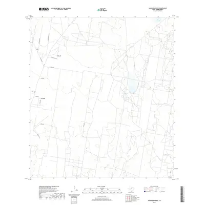
2019 Map of Sagunada Ranch
USGS Topo · Published 2019About this map
Sagunada Ranch and the surrounding ranchlands of Starr County are characterized by a long-standing pattern of large family holdings and rural colonization. In this 2019 survey, the landscape is defined by the transition from traditional grazing lands to modern residential subdivisions, seen in the grid of La Carla and the surrounding road network. The influence of local ranching families is evident in names like Woods Brothers Rd and El Brazil Ranch Ln, which provide access to interior tracts. The persistence of these names alongside newer developments like Las Brisas Rd reflects the evolving land use in this part of South Texas, where expansive pastures are increasingly partitioned by private roads and lanes like Papalotitos Ln and Tanque Rd.
Find a feature on this map
14 named features on this map. Tap any name to fly to it.
Don’t see what you’re looking for? This feature index may not catch every label — zoom into the map to look around manually.
Map Details
Editions of this 2019 Sagunada Ranch Map
This is the sole edition of this map. No revisions or reprints were ever made.
Other maps of this area

1938 · El Sauz
USGS Topo · 1:62,500

1938 · Sal Colorada
USGS Topo · 1:62,500

1949 · Mc Allen
USGS Topo · 1:250,000

1954 · McAllen
USGS Topo · 1:250,000

1956 · Garcias
USGS Topo · 1:62,500

1956 · Escobares
USGS Topo · 1:62,500

1957 · Mc Allen
USGS Topo · 1:250,000

1962 · McAllen
USGS Topo · 1:250,000

1965 · Rio Grande City South
USGS Topo · 1:24,000

1965 · La Grulla
USGS Topo · 1:24,000