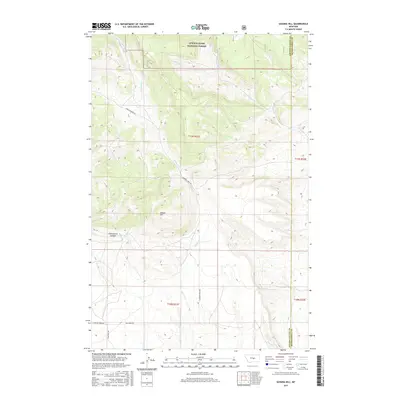
2017 Map of Sahara Hill
USGS Topo · Published 2017About this map
Lewis & Clark National Forest spans the northern reaches of this central Montana terrain, where the high country transitions into the drainage systems of the Musselshell basin. The topographic relief is defined by Sahara Hill and the deep incision of Stonehouse Canyon to the west. This landscape is a network of seasonal watercourses and ridges, with Cameron Cr winding through the central valley alongside Cameron Creek Rd. The map documents a sparsely populated ranching and forest boundary area along the border of Golden Valley and Musselshell Counties. To the east, the headwaters of Pole Cr branch into numerous forks, including N Fork Pole Cr and S Fork Pole Cr, illustrating the complex hydrology of this arid upland environment during the early 21st century.
Find a feature on this map
17 named features on this map. Tap any name to fly to it.
Don’t see what you’re looking for? This feature index may not catch every label — zoom into the map to look around manually.
Map Details
Editions of this 2017 Sahara Hill Map
This is the sole edition of this map. No revisions or reprints were ever made.
Other maps of this area

1889 · Big Snowy Mountain
USGS Topo · 1:250,000

1893 · Big Snowy Mountain
USGS Topo · 1:250,000

1954 · Roundup
USGS Topo · 1:250,000

1958 · Roundup
USGS Topo · 1:250,000

1970 · South Bench
USGS Topo · 1:24,000
1970 · Alaska Bench
USGS Topo · 1:24,000

1986 · Devils Hole Lake
USGS Topo · 1:24,000

1986 · Patterson Canyon
USGS Topo · 1:24,000

1986 · Emory School
USGS Topo · 1:24,000
1986 · Sahara Hill
USGS Topo · 1:24,000