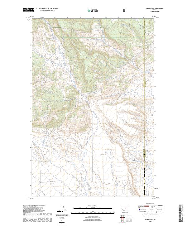
2024 Map of Sahara Hill
USGS Topo · Published 2024About this map
Lewis & Clark National Forest spans the northern reaches of this Montana landscape, where the southern slopes of the Little Snowy Mountains meet the high plains. The terrain is defined by a series of drainage networks, most notably Cameron Creek, which cuts southward past its eponymous Cameron Creek Rd. The namesake Sahara Hill rises as a prominent landmark in the central-western portion of the quadrangle, situated just east of the deep cleft of Stonehouse Canyon.
Find a feature on this map
14 named features on this map. Tap any name to fly to it.
Don’t see what you’re looking for? This feature index may not catch every label — zoom into the map to look around manually.
Map Details
Editions of this 2024 Sahara Hill Map
This is the sole edition of this map. No revisions or reprints were ever made.
Other maps of this area

1889 · Big Snowy Mountain
USGS Topo · 1:250,000

1893 · Big Snowy Mountain
USGS Topo · 1:250,000

1954 · Roundup
USGS Topo · 1:250,000

1958 · Roundup
USGS Topo · 1:250,000

1970 · South Bench
USGS Topo · 1:24,000
1970 · Alaska Bench
USGS Topo · 1:24,000

1986 · Devils Hole Lake
USGS Topo · 1:24,000

1986 · Patterson Canyon
USGS Topo · 1:24,000

1986 · Emory School
USGS Topo · 1:24,000
1986 · Sahara Hill
USGS Topo · 1:24,000