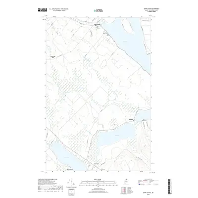
2018 Map of Saint Agatha
USGS Topo · Published 2018About this map
Long Lake and the connected waters of the Fish River chain dominate this northern Aroostook County landscape. In the village of Saint Agatha, the local topography is marked by significant cultural landmarks including Upper Saint Agatha Cem and Lower Saint Agatha Cem. The settlement pattern reflects a deep-rooted connection to the water, with homes and roads like Lakeview Dr and Lake Shore Rd hugging the shoreline. To the west, Carriveau Mill stands along the drainage of W Fork McLean Brook, signifying the area's historical reliance on timber and water power. Further south, the settlements of Sinclair and Guerette bridge the gap between Mud Lake and Cross Lake, where Matrimony Point juts into the water. This modern survey details a region where traditional French-Acadian influences persist through its cemeteries and established hamlets.
Find a feature on this map
47 named features on this map. Tap any name to fly to it.
Don’t see what you’re looking for? This feature index may not catch every label — zoom into the map to look around manually.
Map Details
Editions of this 2018 Saint Agatha Map
This is the sole edition of this map. No revisions or reprints were ever made.
Other maps of this area

1927 · Stockholm
USGS Topo · 1:48,000

1927 · Square Lake
USGS Topo · 1:48,000

1931 · Square Lake
USGS Topo · 1:62,500

1931 · Stockholm
USGS Topo · 1:62,500

1932 · Frenchville
USGS Topo · 1:48,000

1935 · Frenchville
USGS Topo · 1:62,500

1938 · Grand Isle
USGS Topo · 1:62,500

1940 · Grand Isle
USGS Topo · 1:62,500

1953 · Stockholm
USGS Topo · 1:62,500

1953 · Square Lake
USGS Topo · 1:62,500
Featured Places
- Madawaska, ME
- Saint Agatha, ME
- Cross Lake Township, ME
- Sinclair Township, ME
- Guerette, Cross Lake Township