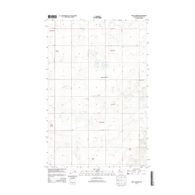
2014 Map of Saint Andrews
USGS Topo · Published 2014About this map
The high plateau of the Big Bend country is defined here by the small community of Saint Andrews, where a grid of rural roads connects scattered homesteads and agricultural tracts. This 2014 survey captures a landscape punctuated by seasonal water bodies and depressions, including Tub Springs Lake, Haynes Lake, and Stallard Lake. For family historians, the presence of the Danish Cem and the Saint Andrews Cem provides specific points of reference for the early settlers who established this dryland farming region. The terrain is marked by significant topographical shifts, from the depths of Long Canyon to the rise of Gilbert Butte in the southeast. A strictly structured road network, featuring routes like Buckeye Rd NE and Woods Rd NE, outlines the section lines of the Public Land Survey System that governs the layout of these Douglas County lands.
Find a feature on this map
27 named features on this map. Tap any name to fly to it.
Don’t see what you’re looking for? This feature index may not catch every label — zoom into the map to look around manually.
Map Details
Editions of this 2014 Saint Andrews Map
This is the sole edition of this map. No revisions or reprints were ever made.
Other maps of this area

1930 · Grand Coulee Sheet 3
USGS Topo · 1:31,680

1953 · Ritzville
USGS Topo · 1:250,000

1959 · Ritzville
USGS Topo · 1:250,000

1965 · Ritzville
USGS Topo · 1:250,000

1965 · Jameson Lake SE
USGS Topo · 1:24,000

1965 · St. Andrews
USGS Topo · 1:24,000

1965 · Jameson Lake East
USGS Topo · 1:24,000

1965 · Mold
USGS Topo · 1:24,000
1965 · Park Lake
USGS Topo · 1:24,000

1965 · Coulee City
USGS Topo · 1:24,000