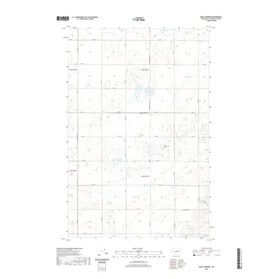
2020 Map of Saint Andrews
USGS Topo · Published 2020About this map
Saint Andrews sits at the heart of this Douglas County landscape, where the high desert terrain is punctuated by a series of small, scattered lakes. The settlement pattern is defined by a rigid grid of rural roads, including St Andrews North Rd NE and Heritage Rd NE, which carve the plateau into large agricultural or open parcels. Local history and genealogy are preserved at the Saint Andrews Cem and the nearby Danish Cem, markers of the community's early 20th-century origins. In the southern portion of the quadrangle, the land rises toward Gilbert Butte, while the hydrology is characterized by seasonal or shallow bodies of water such as Tub Springs Lake, Stallard Lake, and Haynes Lake, which serve as vital landmarks in this arid environment.
Find a feature on this map
35 named features on this map. Tap any name to fly to it.
Don’t see what you’re looking for? This feature index may not catch every label — zoom into the map to look around manually.
Map Details
Editions of this 2020 Saint Andrews Map
This is the sole edition of this map. No revisions or reprints were ever made.
Other maps of this area

1930 · Grand Coulee Sheet 3
USGS Topo · 1:31,680

1953 · Ritzville
USGS Topo · 1:250,000

1959 · Ritzville
USGS Topo · 1:250,000

1965 · Ritzville
USGS Topo · 1:250,000

1965 · Jameson Lake SE
USGS Topo · 1:24,000

1965 · St. Andrews
USGS Topo · 1:24,000

1965 · Jameson Lake East
USGS Topo · 1:24,000

1965 · Mold
USGS Topo · 1:24,000
1965 · Park Lake
USGS Topo · 1:24,000

1965 · Coulee City
USGS Topo · 1:24,000