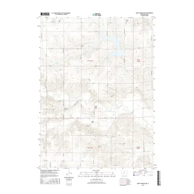
2015 Map of Saint Charles NW
USGS Topo · Published 2015About this map
McBride Covered Bridge and Miller Bridge stand as prominent landmarks in this Iowa landscape, where the meandering course of the N Br North River and Badger Cr shape the terrain. The map reveals a dense network of country roads like Old Portland Rd and Quail Ridge Ave that connect a series of family and denominational burial grounds. These include the Blue Ridge Cem, German Lutheran Cem, and United Brethren Cem, providing essential touchstones for genealogical research in Madison and Warren counties. The distribution of these cemeteries, alongside the North McDonald Cem and Jefferson Cem, suggests a settled rural community deeply rooted in its local geography. Tributaries such as N River and N Elm Cr further define the drainage patterns of the region's agricultural heartland.
Find a feature on this map
59 named features on this map. Tap any name to fly to it.
Don’t see what you’re looking for? This feature index may not catch every label — zoom into the map to look around manually.
Map Details
Editions of this 2015 Saint Charles NW Map
This is the sole edition of this map. No revisions or reprints were ever made.
Other maps of this area

1908 · Waukee
USGS Topo · 1:62,500

1949 · Adel
USGS Topo · 1:62,500

1951 · Adel
USGS Topo · 1:62,500

1951 · St. Charles
USGS Topo · 1:62,500

1952 · Winterset
USGS Topo · 1:62,500

1954 · Omaha
USGS Topo · 1:250,000

1954 · Des Moines
USGS Topo · 1:250,000

1956 · Des Moines
USGS Topo · 1:250,000

1957 · Des Moines
USGS Topo · 1:250,000

1957 · Omaha
USGS Topo · 1:250,000