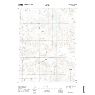
2018 Map of Saint Charles NW
USGS Topo · Published 2018About this map
McBride Covered Bridge spans the N Br N River in this rural Madison County landscape, reflecting the engineering heritage of a region known for its historic river crossings. The terrain is defined by the winding tributaries of the N River and Cedar Cr, which carve deep valleys through the agricultural uplands. Numerous small burial grounds, including the German Lutheran Cem, United Brethren Cem, and North McDonald Cem, are scattered across the section lines, marking the early settlement patterns of various religious and family groups. Further north, Badger Creek Lake provides a significant water feature, fed by Badger Cr. This 2018 survey detail shows a network of established county roads, such as Co Rd G14 and Co Rd G4R, that continue to follow the rectilinear logic of the original land surveys while navigating the area's complex drainage systems.
Find a feature on this map
38 named features on this map. Tap any name to fly to it.
Don’t see what you’re looking for? This feature index may not catch every label — zoom into the map to look around manually.
Map Details
Editions of this 2018 Saint Charles NW Map
This is the sole edition of this map. No revisions or reprints were ever made.
Other maps of this area

1908 · Waukee
USGS Topo · 1:62,500

1949 · Adel
USGS Topo · 1:62,500

1951 · Adel
USGS Topo · 1:62,500

1951 · St. Charles
USGS Topo · 1:62,500

1952 · Winterset
USGS Topo · 1:62,500

1954 · Omaha
USGS Topo · 1:250,000

1954 · Des Moines
USGS Topo · 1:250,000

1956 · Des Moines
USGS Topo · 1:250,000

1957 · Des Moines
USGS Topo · 1:250,000

1957 · Omaha
USGS Topo · 1:250,000