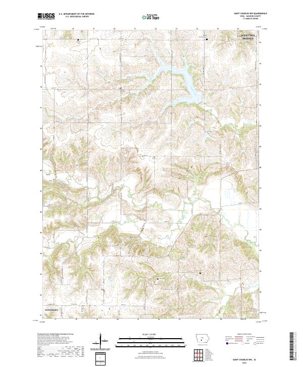
2022 Map of Saint Charles NW
USGS Topo · Published 2022About this map
German Lutheran Cem and Neal Cem are among several burial grounds that anchor this rural landscape in Madison County. The area is defined by the winding course of the N Br N River and its numerous tributaries, including Badger Creek and N Elm Cr. While the outskirts of West Des Moines appear at the northern edge and a portion of Winterset sits in the southwest corner, the interior remains a patchwork of agricultural sections bounded by an extensive network of local roads like Old Portland Rd and Badger Creek Rd. This modern survey reveals how the township structure of the 19th century persists through modern infrastructure, maintaining historical site markers such as the United Brethren Cem and Payton Cem even as suburban growth approaches from the north.
Find a feature on this map
61 named features on this map. Tap any name to fly to it.
Don’t see what you’re looking for? This feature index may not catch every label — zoom into the map to look around manually.
Map Details
Editions of this 2022 Saint Charles NW Map
This is the sole edition of this map. No revisions or reprints were ever made.
Other maps of this area

1908 · Waukee
USGS Topo · 1:62,500

1949 · Adel
USGS Topo · 1:62,500

1951 · Adel
USGS Topo · 1:62,500

1951 · St. Charles
USGS Topo · 1:62,500

1952 · Winterset
USGS Topo · 1:62,500

1954 · Omaha
USGS Topo · 1:250,000

1954 · Des Moines
USGS Topo · 1:250,000

1956 · Des Moines
USGS Topo · 1:250,000

1957 · Des Moines
USGS Topo · 1:250,000

1957 · Omaha
USGS Topo · 1:250,000