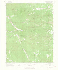
1963 Map of Saint Charles Peak
USGS Topo · Published 1966About this map
San Isabel National Forest dominates this 1963 survey, revealing a landscape defined by its high-altitude topography and recreational infrastructure. The western edge of the map features Highway 165 winding through the terrain near the small settlement of Fairview. To the east, Pueblo Mountain Park provides a dedicated mountain preserve, while the interior of the forest is marked by significant landmarks like Potato Mountain and the prominent Saint Charles Peak. This era of the forest's management is characterized by a network of primitive access routes, including the Mage Trail and the Silver Circle pack trail. Hydrology is central to the area's layout, with Squirrel Creek and Saint Charles Creek carving deep drainage patterns. Several named meadows, such as Burris Meadow and Simonson Meadow, indicate breaks in the dense forest cover that served as vital markers for local travelers and early surveyors.
Find a feature on this map
42 named features on this map. Tap any name to fly to it.
Don’t see what you’re looking for? This feature index may not catch every label — zoom into the map to look around manually.
Map Details
Editions of this 1963 Saint Charles Peak Map
3 editions found
Other maps of this area

1889 · Canon City
USGS Topo · 1:125,000

1889 · Huerfano Park
USGS Topo · 1:125,000

1891 · Walsenburg
USGS Topo · 1:125,000

1891 · Pueblo
USGS Topo · 1:125,000

1892 · Huerfano Park
USGS Topo · 1:125,000

1892 · Canon City
USGS Topo · 1:125,000

1894 · Walsenburg
USGS Topo · 1:125,000

1894 · Pueblo
USGS Topo · 1:125,000

1896 · Pueblo
USGS Topo · 1:125,000

1897 · Pueblo
USGS Topo · 1:125,000