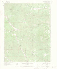
1963 Map of Saint Charles Peak
USGS Topo · Published 1971About this map
The San Isabel National Forest dominates this 1963 survey of the Wet Mountains, where the drainage divide between the Saint Charles River and various northern creeks shapes the human geography. The area reflects a mid-century focus on forest recreation and resource management, anchored by sites like the North Creek Campground, Ophir Creek Campground, and the Davenport Picnic Area. Transportation through this high-altitude landscape is defined by the Greenhorn Highway and Ophir Creek Road, providing access to the tiny settlement of Fairview and landmarks like Saint Charles Peak.
Find a feature on this map
41 named features on this map. Tap any name to fly to it.
Don’t see what you’re looking for? This feature index may not catch every label — zoom into the map to look around manually.
Map Details
Editions of this 1963 Saint Charles Peak Map
3 editions found
Other maps of this area

1889 · Canon City
USGS Topo · 1:125,000

1889 · Huerfano Park
USGS Topo · 1:125,000

1891 · Walsenburg
USGS Topo · 1:125,000

1891 · Pueblo
USGS Topo · 1:125,000

1892 · Huerfano Park
USGS Topo · 1:125,000

1892 · Canon City
USGS Topo · 1:125,000

1894 · Walsenburg
USGS Topo · 1:125,000

1894 · Pueblo
USGS Topo · 1:125,000

1896 · Pueblo
USGS Topo · 1:125,000

1897 · Pueblo
USGS Topo · 1:125,000