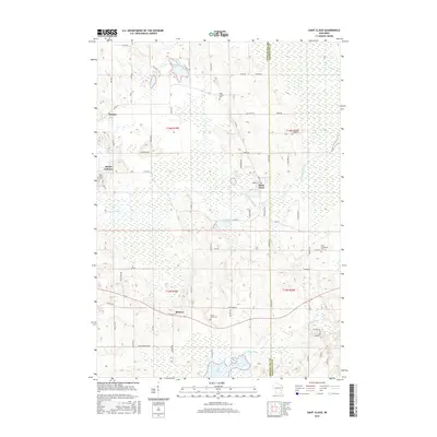
2015 Map of Saint Cloud
USGS Topo · Published 2015About this map
Saint Cloud and Mount Calvary anchor this landscape along the border of Fond du Lac and Sheboygan Counties. The region is defined by its glacial hydrology, with the Sheboygan River winding through the center and the Mullet River flowing past the southern wetlands of Mullet Marsh. Several small water bodies, including Wolf Lake and Paulys Lake, are interspersed among a network of rural roads such as Maple Rd and Co Rd G. Small communities and crossroads like Calvary and Banner appear alongside several significant burial grounds, including Saint Joseph Cem and Forest Home Cem. The map reveals a land divided between agricultural use and protected wetlands, notably the area around Mischos Pond. The proximity of religious and community sites like Holy Cross Cem suggests a settled heritage centered around these early village hubs.
Find a feature on this map
69 named features on this map. Tap any name to fly to it.
Don’t see what you’re looking for? This feature index may not catch every label — zoom into the map to look around manually.
Map Details
Editions of this 2015 Saint Cloud Map
This is the sole edition of this map. No revisions or reprints were ever made.
Other maps of this area

1910 · Fond du Lac
USGS Topo · 1:62,500

1954 · Kiel
USGS Topo · 1:62,500

1955 · Campbellsport
USGS Topo · 1:62,500

1955 · Kewaskum
USGS Topo · 1:62,500

1955 · Fond Du Lac
USGS Topo · 1:62,500

1957 · Madison
USGS Topo · 1:250,000

1960 · Madison
USGS Topo · 1:250,000

1974 · St. Cloud
USGS Topo · 1:24,000
1974 · Kiel
USGS Topo · 1:24,000
1974 · Elkhart Lake
USGS Topo · 1:24,000