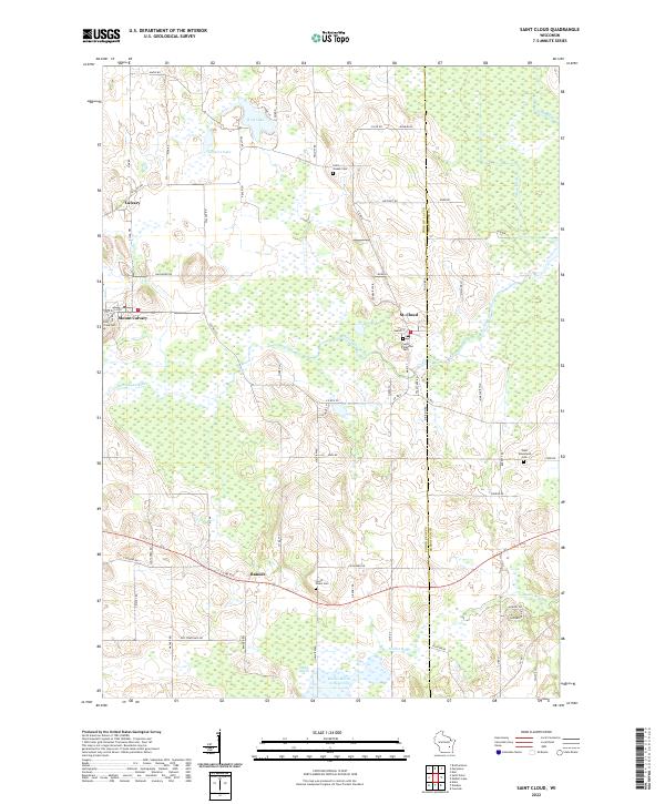
2022 Map of Saint Cloud
USGS Topo · Published 2022About this map
St. Cloud serves as a central hub in this section of eastern Wisconsin, situated where the Sheboygan River winds through a landscape defined by significant wetland areas and small glacial lakes. The village of Mount Calvary stands out to the west, marked by the presence of Holy Cross Cem, while the smaller settlement of Calvary lies just to the north. This region shows a transition between the established village centers and the more open marshlands to the south, such as the Mullet Marsh 15 Reservoir and the broader Mullet Marsh.
Find a feature on this map
76 named features on this map. Tap any name to fly to it.
Don’t see what you’re looking for? This feature index may not catch every label — zoom into the map to look around manually.
Map Details
Editions of this 2022 Saint Cloud Map
This is the sole edition of this map. No revisions or reprints were ever made.
Other maps of this area

1910 · Fond du Lac
USGS Topo · 1:62,500

1954 · Kiel
USGS Topo · 1:62,500

1955 · Campbellsport
USGS Topo · 1:62,500

1955 · Kewaskum
USGS Topo · 1:62,500

1955 · Fond Du Lac
USGS Topo · 1:62,500

1957 · Madison
USGS Topo · 1:250,000

1960 · Madison
USGS Topo · 1:250,000

1974 · St. Cloud
USGS Topo · 1:24,000
1974 · Kiel
USGS Topo · 1:24,000
1974 · Elkhart Lake
USGS Topo · 1:24,000