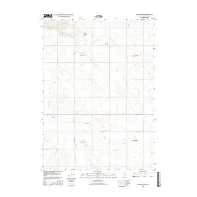
2015 Map of Saint Francis SW
USGS Topo · Published 2015About this map
Sawmill Canyon cuts through the northern reaches of this landscape in Todd County, highlighting the drainage patterns that define this section of the Great Plains. The terrain is characterized by the meandering courses of Bull Creek to the east and Minnechaduza Creek to the south, both of which serve as primary hydrologic features in an otherwise expansive upland area. The 2015 survey reveals a sparse network of section roads, such as 258th Ave and 300th St, which organize the rural space around the townships of t36n r31w, t36n r30w, t35n r31w, and t35n r30w. For those researching local burial sites or family history, Star Cem is a notable landmark located in the northern half of the quadrangle. Transportation is primarily limited to named rural routes like Two Eagle Rd, illustrating the modern layout of this ranching and agricultural region.
Find a feature on this map
15 named features on this map. Tap any name to fly to it.
Don’t see what you’re looking for? This feature index may not catch every label — zoom into the map to look around manually.
Map Details
Editions of this 2015 Saint Francis SW Map
This is the sole edition of this map. No revisions or reprints were ever made.
Other maps of this area

1950 · Kilgore
USGS Topo · 1:62,500

1950 · Cody
USGS Topo · 1:62,500

1955 · Martin
USGS Topo · 1:250,000

1957 · Valentine
USGS Topo · 1:250,000

1958 · Martin
USGS Topo · 1:250,000

1959 · Valentine
USGS Topo · 1:250,000

1969 · Iron Shell Flat East
USGS Topo · 1:24,000

1969 · Rosebud
USGS Topo · 1:24,000

1969 · Spring Creek
USGS Topo · 1:24,000

1969 · St. Francis SW
USGS Topo · 1:24,000
Featured Places
- St. Francis Segment, SD
- Spring Creek Segment, SD
- Spring Creek, Spring Creek Segment
- Todd County, SD
- United States