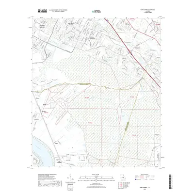
2018 Map of Saint Gabriel
USGS Topo · Published 2018About this map
St. Gabriel sits along a prominent bend of the Mississippi River, serving as a focal point for this landscape where industrial infrastructure and historical settlements meet the alluvial wetlands of the lower river. The map details the transition from the suburban expansion of Baton Rouge in the north, including Oak Hills Place and Village St. George, to the vast lowlands of Bluff Swamp and Spanish Lake. This southern portion of the quadrangle is defined by a complex network of waterways, including Bayou Manchac and Bayou Paul, which historically served as critical drainage and boundary markers between East Baton Rouge Parish, Iberville Parish, and Ascension Parish. Researchers can find numerous smaller communities such as Iberville, Sunshine, and Point Pleasant, alongside several burial sites like Saint Gabriel Cem and Mount Carmel Cem.
Find a feature on this map
178 named features on this map. Tap any name to fly to it.
Don’t see what you’re looking for? This feature index may not catch every label — zoom into the map to look around manually.
Map Details
Editions of this 2018 Saint Gabriel Map
This is the sole edition of this map. No revisions or reprints were ever made.
Other maps of this area

1892 · Donaldsonville
USGS Topo · 1:62,500

1908 · Baton Rouge
USGS Topo · 1:62,500

1934 · Denham Springs
USGS Topo · 1:62,500

1935 · Gonzales
USGS Topo · 1:31,680

1936 · White Castle
USGS Topo · 1:62,500

1939 · Denham Springs
USGS Topo · 1:62,500

1939 · Baton Rouge
USGS Topo · 1:62,500

1939 · Donaldsonville
USGS Topo · 1:62,500

1953 · Baton Rouge West
USGS Topo · 1:24,000

1953 · Plaquemine
USGS Topo · 1:24,000