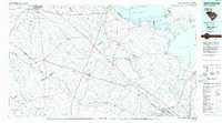
1985 Map of Saint George
USGS Topo · Published 1986About this map
Lake Marion and Lake Moultrie dominate the northern and eastern portions of this mid-1980s planimetric study, marking the Lowcountry landscape where the Santee River and the Cooper River headwaters converge. The interior is defined by an intricate network of wetlands, most notably the expansive Four Hole Swamp and Cypress Swamp, which separate upland settlements like St George and Holly Hill from the surrounding river basins. This era shows the established path of the Southern Railway and Seaboard System lines as they cut through rural timber and agricultural lands.
Find a feature on this map
152 named features on this map. Tap any name to fly to it.
Don’t see what you’re looking for? This feature index may not catch every label — zoom into the map to look around manually.
Map Details
Editions of this 1985 Saint George Map
This is the sole edition of this map. No revisions or reprints were ever made.
Other maps of this area

1918 · Walterboro
USGS Topo · 1:62,500

1918 · Varnville
USGS Topo · 1:62,500

1918 · Cottageville
USGS Topo · 1:62,500

1919 · Ladson
USGS Topo · 1:21,120

1919 · Summerville
USGS Topo · 1:48,000

1919 · Olar
USGS Topo · 1:62,500

1919 · Ridgeville
USGS Topo · 1:48,000

1919 · Cordesville
USGS Topo · 1:48,000

1919 · Melgrove
USGS Topo · 1:21,120

1919 · Bamberg
USGS Topo · 1:48,000