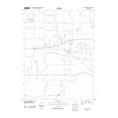
2009 Map of Saint George
USGS Topo · Published 2009About this map
Saint George occupies a prominent position on the northern bank of the Kansas River, illustrating the enduring importance of river valley settlements in this part of Kansas. The landscape is defined by the winding course of the river and its numerous tributaries, including Blackjack Creek and Deep Creek, which carve through the terrain south of the main channel. To the north, the area around Elbo Creek shows modern residential growth with developments like those along Elbo View Dr and Elbo Bluff Dr.
Find a feature on this map
79 named features on this map. Tap any name to fly to it.
Don’t see what you’re looking for? This feature index may not catch every label — zoom into the map to look around manually.
Map Details
Editions of this 2009 Saint George Map
This is the sole edition of this map. No revisions or reprints were ever made.
Other maps of this area

1886 · Junction City
USGS Topo · 1:125,000

1889 · Wamego
USGS Topo · 1:125,000

1889 · Junction City
USGS Topo · 1:125,000

1894 · Junction City
USGS Topo · 1:125,000

1894 · Wamego
USGS Topo · 1:125,000

1947 · Manhattan
USGS Topo · 1:62,500

1950 · Manhattan
USGS Topo · 1:24,000

1951 · Swede Creek
USGS Topo · 1:24,000

1953 · Wamego
USGS Topo · 1:24,000

1953 · St George
USGS Topo · 1:24,000