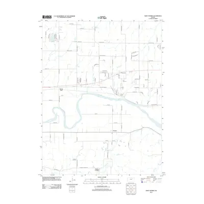
2012 Map of Saint George
USGS Topo · Published 2012About this map
The Kansas River cuts a wide, meandering path through this part of Riley County, defining a landscape shaped by both water and historical transit. Along its southern banks, the community of Zeandale sits near the mouth of Deep Cr, while further south, the Pillsbury Crossing provides a named landmark for those navigating the local creek systems. The terrain is marked by significant drainage features like Elm Slough and Blackjack Cr, which flow through a grid of rural roads that still bear names suggesting early settlement and purpose, such as Mount Zion Rd and the significant Military Trail Rd. Genealogists will find the Saint George Cem and Pleasant Valley Cem clearly documented, offering vital touchstones for family history in the area. North of the river, the residential development around Lake Elbo and the curious label of Swamp Angel stand out against the surrounding agricultural fields.
Find a feature on this map
85 named features on this map. Tap any name to fly to it.
Don’t see what you’re looking for? This feature index may not catch every label — zoom into the map to look around manually.
Map Details
Editions of this 2012 Saint George Map
This is the sole edition of this map. No revisions or reprints were ever made.
Other maps of this area

1886 · Junction City
USGS Topo · 1:125,000

1889 · Wamego
USGS Topo · 1:125,000

1889 · Junction City
USGS Topo · 1:125,000

1894 · Junction City
USGS Topo · 1:125,000

1894 · Wamego
USGS Topo · 1:125,000

1947 · Manhattan
USGS Topo · 1:62,500

1950 · Manhattan
USGS Topo · 1:24,000

1951 · Swede Creek
USGS Topo · 1:24,000

1953 · Wamego
USGS Topo · 1:24,000

1953 · St George
USGS Topo · 1:24,000