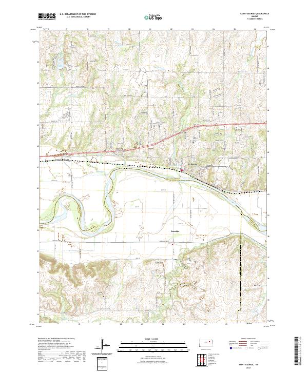
2022 Map of Saint George
USGS Topo · Published 2022About this map
The Kansas River carves a winding path through this landscape, marking the historic boundary between Pottawatomie, Riley, and Wabaunsee counties. The settlement of St. George sits on the northern bank, characterized by a grid of streets that transition into the surrounding agricultural highlands. To the south, the community of Zeandale is situated along Zeandale Rd, serving as a central point for the rural valley. This area is defined by its complex drainage network, with Blackjack Cr and Sand Cr feeding into the river from the north, while the southern terrain is sculpted by Deep Cr. For those tracing local history, the map identifies several significant cultural landmarks, including the Saint George Cem and Pleasant Valley Cem, alongside uniquely named locales such as Swamp Angel and the elevated Elbo Bluff overlooking Lake Elbo.
Find a feature on this map
56 named features on this map. Tap any name to fly to it.
Don’t see what you’re looking for? This feature index may not catch every label — zoom into the map to look around manually.
Map Details
Editions of this 2022 Saint George Map
This is the sole edition of this map. No revisions or reprints were ever made.
Other maps of this area

1886 · Junction City
USGS Topo · 1:125,000

1889 · Wamego
USGS Topo · 1:125,000

1889 · Junction City
USGS Topo · 1:125,000

1894 · Junction City
USGS Topo · 1:125,000

1894 · Wamego
USGS Topo · 1:125,000

1947 · Manhattan
USGS Topo · 1:62,500

1950 · Manhattan
USGS Topo · 1:24,000

1951 · Swede Creek
USGS Topo · 1:24,000

1953 · Wamego
USGS Topo · 1:24,000

1953 · St George
USGS Topo · 1:24,000