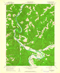
1959 Map of Saint George
USGS Topo · Published 1961About this map
Saint George sits at the heart of this late-1950s landscape, positioned near the convergence of Minear Run and the Cheat River. The terrain is defined by steep ridges and narrow valleys, where small communities and family-named landmarks like Hannahsville and Auvil are connected by winding river-hugging roads. Much of the eastern portion of the map is dominated by the Monongahela National Forest, showcasing a period of transition where remote forest lands are punctuated by active Gas Wells and small rural institutions. Local history is deeply embedded in the land through numerous religious and educational sites, including Bethel Ch, Macedonia Ch, and Fairview Sch. The dramatic loop of the Horseshoe Bend south of town stands out as a significant geographical feature, alongside Horseshoe Run, which serves the agricultural Meadows area where Camp Kidd is located.
Find a feature on this map
54 named features on this map. Tap any name to fly to it.
Don’t see what you’re looking for? This feature index may not catch every label — zoom into the map to look around manually.
Map Details
Editions of this 1959 Saint George Map
2 editions found
Other maps of this area

1886 · St. George
USGS Topo · 1:125,000

1891 · St. George
USGS Topo · 1:125,000

1907 · Thornton
USGS Topo · 1:62,500

1907 · Kingwood
USGS Topo · 1:62,500

1907 · Belington
USGS Topo · 1:62,500

1908 · Parsons
USGS Topo · 1:62,500

1925 · Kingwood
USGS Topo · 1:62,500

1926 · Thornton
USGS Topo · 1:62,500

1926 · Parsons
USGS Topo · 1:62,500

1927 · Belington
USGS Topo · 1:62,500