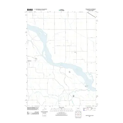
2011 Map of Saint Helena
USGS Topo · Published 2011About this map
Saint Helena sits along the southern banks of the Missouri River in this Cedar County survey, where the river channel creates a complex network of islands and sandbars including Saint Helena Island. The community is anchored by local history markers such as the Saint Helena Cemetery and Danisl Cemetery. To the southeast, the landscape is defined by the drainage of Bow Creek, which is joined by West Bow Creek and Second Bow Creek near the settlement of Bow Valley Mills. This era of the landscape shows a transition from the structured grid of rural roads like Union School Rd to the recreational areas at the New Homewood Park Campgrounds near the river's bend. The topography reveals how the Missouri's course continues to shape the Nebraska-South Dakota borderlands, influencing the placement of original settlements and mill sites.
Find a feature on this map
39 named features on this map. Tap any name to fly to it.
Don’t see what you’re looking for? This feature index may not catch every label — zoom into the map to look around manually.
Map Details
Editions of this 2011 Saint Helena Map
This is the sole edition of this map. No revisions or reprints were ever made.
Other maps of this area

1955 · Sioux City
USGS Topo · 1:250,000

1957 · Gayville
USGS Topo · 1:24,000

1957 · Mission Hill
USGS Topo · 1:24,000

1958 · Sioux City
USGS Topo · 1:250,000

1959 · Sioux City
USGS Topo · 1:250,000

1968 · Obert
USGS Topo · 1:24,000

1968 · St. Helena
USGS Topo · 1:24,000

1968 · Wynot
USGS Topo · 1:24,000
1968 · Meckling
USGS Topo · 1:24,000

1968 · Fordyce
USGS Topo · 1:24,000