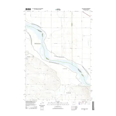
2014 Map of Saint Helena
USGS Topo · Published 2014About this map
The Missouri River forms a wide, braided corridor along the Nebraska and South Dakota border, a landscape preserved here as the Missouri National Recreational River. On the Nebraska side, the village of St. Helena sits on the bluffs overlooking the river valley, supported by the nearby Saint Helena Cem. To the east, Saint Helena Island sits within the shifting channels of the river, while the southern portion of the map transitions into a network of small streams and agricultural drainage including Bow Cr and Second Bow Cr.
Find a feature on this map
36 named features on this map. Tap any name to fly to it.
Don’t see what you’re looking for? This feature index may not catch every label — zoom into the map to look around manually.
Map Details
Editions of this 2014 Saint Helena Map
This is the sole edition of this map. No revisions or reprints were ever made.
Other maps of this area

1955 · Sioux City
USGS Topo · 1:250,000

1957 · Gayville
USGS Topo · 1:24,000

1957 · Mission Hill
USGS Topo · 1:24,000

1958 · Sioux City
USGS Topo · 1:250,000

1959 · Sioux City
USGS Topo · 1:250,000

1968 · Obert
USGS Topo · 1:24,000

1968 · St. Helena
USGS Topo · 1:24,000

1968 · Wynot
USGS Topo · 1:24,000
1968 · Meckling
USGS Topo · 1:24,000

1968 · Fordyce
USGS Topo · 1:24,000