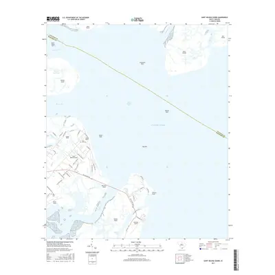
2017 Map of Saint Helena Sound
USGS Topo · Published 2017About this map
Saint Helena Island and its surrounding archipelago define this coastal landscape where the Combahee River, Ashepoo River, and Morgan River converge into the Saint Helena Sound. The map reveals a complex network of tidal creeks and islands, from the larger Morgan Island and Hunting Island to smaller landmasses like Butchers Island and Horse Island. Settlement patterns are concentrated along local thoroughfares such as the Sea Island Pkwy, with specific residential clusters at Fripps Point and Coffin Point.
Find a feature on this map
60 named features on this map. Tap any name to fly to it.
Don’t see what you’re looking for? This feature index may not catch every label — zoom into the map to look around manually.
Map Details
Editions of this 2017 Saint Helena Sound Map
This is the sole edition of this map. No revisions or reprints were ever made.
Other maps of this area

1918 · Green Pond
USGS Topo · 1:62,500

1919 · Edisto Island
USGS Topo · 1:62,500

1920 · St. Helena Sound
USGS Topo · 1:62,500

1943 · Edisto Island
USGS Topo · 1:62,500

1943 · Green Pond
USGS Topo · 1:62,500

1944 · Fort Fremont
USGS Topo · 1:62,500

1947 · Savannah
USGS Topo · 1:250,000

1948 · St. Helena Sound
USGS Topo · 1:62,500

1948 · Savannah
USGS Topo · 1:250,000

1956 · Frogmore
USGS Topo · 1:24,000
Featured Places
- Oceanmarsh Subdivision, SC
- Cedar Reef Villas, SC
- Nautical Watch Villas, SC
- Beaufort County, SC
- Colleton County, SC