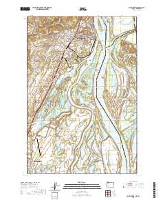
2020 Map of Saint Helens
USGS Topo · Published 2020About this map
The Columbia County Courthouse serves as a central anchor for St. Helens, where the town overlooks the Multnomah Channel and the Columbia River shoreline. This landscape is defined by its complex waterway network, including Scappoose Bay and the numerous sloughs and lakes that weave through Sauvie Island and Bachelor Island. To the south, the Scappoose Industrial Airpark and the town of Scappoose show the region's continued economic development, while the P & W RR rail line maintains its historical corridor through McNulty and West Saint Helens. The map also preserves the locations of vital community landmarks such as the Independent Order of Odd Fellows Cem and Lutheran Cem, providing essential points of reference for genealogists and local historians tracing the settlement patterns of this riverfront territory.
Find a feature on this map
169 named features on this map. Tap any name to fly to it.
Don’t see what you’re looking for? This feature index may not catch every label — zoom into the map to look around manually.
Map Details
Editions of this 2020 Saint Helens Map
This is the sole edition of this map. No revisions or reprints were ever made.
Other maps of this area

1897 · Portland
USGS Topo · 1:62,500

1905 · Portland
USGS Topo · 1:62,500

1915 · Hillsboro
USGS Topo · 1:62,500

1918 · Hillsboro
USGS Topo · 1:62,500

1922 · St. Helens
USGS Topo · 1:62,500

1940 · Hillsboro
USGS Topo · 1:62,500

1940 · Portland
USGS Topo · 1:62,500

1940 · La Center
USGS Topo · 1:62,500

1941 · St Helens
USGS Topo · 1:62,500

1943 · St Helens
USGS Topo · 1:62,500