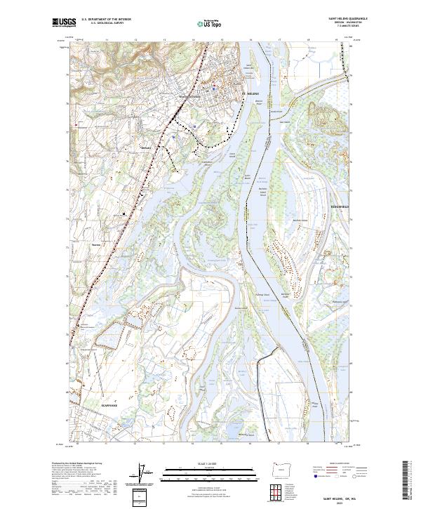
2023 Map of Saint Helens
USGS Topo · Published 2023About this map
The Columbia River serves as the dominant geographic and economic axis of this region, separating St. Helens and Scappoose on the Oregon side from Ridgefield in Washington. This modern survey illustrates a landscape defined by complex riverine features, including Louse Island, Bachelor Island, and the northern tip of Sauvie Island. These landforms, shaped by the Multnomah Channel and Cunningham Slough, create a maze of waterways like Millionaire Lake and Whittier Lake that contrast with the organized street grids of the riverside towns.
Find a feature on this map
184 named features on this map. Tap any name to fly to it.
Don’t see what you’re looking for? This feature index may not catch every label — zoom into the map to look around manually.
Map Details
Editions of this 2023 Saint Helens Map
This is the sole edition of this map. No revisions or reprints were ever made.
Other maps of this area

1897 · Portland
USGS Topo · 1:62,500

1905 · Portland
USGS Topo · 1:62,500

1915 · Hillsboro
USGS Topo · 1:62,500

1918 · Hillsboro
USGS Topo · 1:62,500

1922 · St. Helens
USGS Topo · 1:62,500

1940 · Hillsboro
USGS Topo · 1:62,500

1940 · Portland
USGS Topo · 1:62,500

1940 · La Center
USGS Topo · 1:62,500

1941 · St Helens
USGS Topo · 1:62,500

1943 · St Helens
USGS Topo · 1:62,500