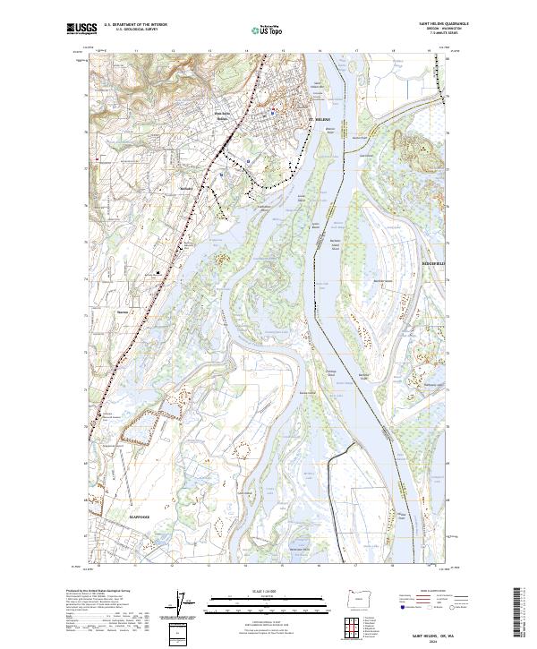
2024 Map of Saint Helens
USGS Topo · Published 2024About this map
St. Helens sits at a critical bend in the Columbia River, where industrial transport and preserved wetland ecosystems meet. This 2024 landscape shows a complex network of sloughs and lakes, including Cunningham Lake, Sturgeon Lake, and Scappoose Bay, which define the low-lying reaches of Sauvie Island. The modern infrastructure of the BNSF Railway and Scappoose Airport contrasts with the dense cluster of historic civic markers in the county seat, such as the Columbia County Courthouse. For genealogists, the map identifies several distinct burial sites including Bethany Memorial Cem, Bayview Memorial Cem, and Columbia Memorial Gardens Cem. The eastern shore, across the state line in Washington, is dominated by the Ridgefield National Wildlife Refuge, illustrating the region's commitment to habitat preservation alongside the established settlements of Warren and Scappoose.
Find a feature on this map
139 named features on this map. Tap any name to fly to it.
Don’t see what you’re looking for? This feature index may not catch every label — zoom into the map to look around manually.
Map Details
Editions of this 2024 Saint Helens Map
This is the sole edition of this map. No revisions or reprints were ever made.
Other maps of this area

1897 · Portland
USGS Topo · 1:62,500

1905 · Portland
USGS Topo · 1:62,500

1915 · Hillsboro
USGS Topo · 1:62,500

1918 · Hillsboro
USGS Topo · 1:62,500

1922 · St. Helens
USGS Topo · 1:62,500

1940 · Hillsboro
USGS Topo · 1:62,500

1940 · Portland
USGS Topo · 1:62,500

1940 · La Center
USGS Topo · 1:62,500

1941 · St Helens
USGS Topo · 1:62,500

1943 · St Helens
USGS Topo · 1:62,500