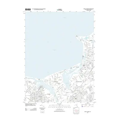
2013 Map of Saint James
USGS Topo · Published 2013About this map
Stony Brook Harbor and the Nissequogue River define the North Shore landscape of Long Island in this 2013 survey. The coastal topography is marked by significant landmarks like Crane Neck Point and Flax Pond, while the inland area shows the established residential patterns of Saint James, Nissequogue, and Old Field. This map is particularly valuable for genealogical research due to the high density of burial grounds, including the historic Bethel Cem, Saint Johnland Cem, and Mills Cem. The layout of the region reflects its long-standing status as a premier residential and recreational area, evidenced by the Nissequogue Golf Course and the Smithtown Landing Municipal Golf Course. Numerous smaller water bodies like Mills Pond and Mill Creek sit tucked between modern road networks, preserving the area's original hydrological character within a suburbanized context.
Find a feature on this map
258 named features on this map. Tap any name to fly to it.
Don’t see what you’re looking for? This feature index may not catch every label — zoom into the map to look around manually.
Map Details
Editions of this 2013 Saint James Map
This is the sole edition of this map. No revisions or reprints were ever made.
Other maps of this area

1891 · Bridgeport
USGS Topo · 1:62,500

1892 · Norwalk
USGS Topo · 1:62,500

1893 · Bridgeport
USGS Topo · 1:62,500

1893 · Norwalk
USGS Topo · 1:62,500

1901 · Northport
USGS Topo · 1:62,500

1902 · Setauket
USGS Topo · 1:62,500

1903 · Northport
USGS Topo · 1:62,500

1904 · Setauket
USGS Topo · 1:62,500

1904 · Islip
USGS Topo · 1:125,000

1919 · Setauket
USGS Topo · 1:62,500