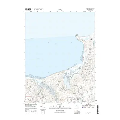
2016 Map of Saint James
USGS Topo · Published 2016About this map
Stony Brook and its neighboring North Shore villages are meticulously documented in this 2016 survey, revealing a landscape defined by the deep indentations of Smithtown Bay and the Long Island Sound. The map captures the suburban density of Saint James and San Remo alongside the more open, coastal reaches of Nissequogue and the northern tip of Old Field. A striking geographic feature is the narrow Nissequogue Neck, which separates the interior wetlands from the open sound. The area’s spiritual and communal history is well-represented by a high concentration of burial grounds, including the Saint James Episcopal Cem and Oak Hill Cem. This 2016 data serves as a precise baseline for researchers tracing the modern layout of private estates, university-related streets such as Fraternity Ln, and the preserved coastal margins of West Meadow Beach.
Find a feature on this map
134 named features on this map. Tap any name to fly to it.
Don’t see what you’re looking for? This feature index may not catch every label — zoom into the map to look around manually.
Map Details
Editions of this 2016 Saint James Map
This is the sole edition of this map. No revisions or reprints were ever made.
Other maps of this area

1891 · Bridgeport
USGS Topo · 1:62,500

1892 · Norwalk
USGS Topo · 1:62,500

1893 · Bridgeport
USGS Topo · 1:62,500

1893 · Norwalk
USGS Topo · 1:62,500

1901 · Northport
USGS Topo · 1:62,500

1902 · Setauket
USGS Topo · 1:62,500

1903 · Northport
USGS Topo · 1:62,500

1904 · Setauket
USGS Topo · 1:62,500

1904 · Islip
USGS Topo · 1:125,000

1919 · Setauket
USGS Topo · 1:62,500