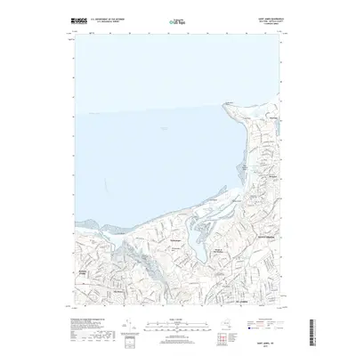
2019 Map of Saint James
USGS Topo · Published 2019About this map
St. James and the surrounding villages of the North Shore represent a landscape defined by glacial geography and long-standing Long Island communities. The Nissequogue River flows north toward Smithtown Bay, carving a path between San Remo and the residential enclaves of Nissequogue. Along the coastline, distinctive formations like Crane Neck Point and West Meadow Beach shelter tidal waters including Flax Pond and Porpoise Channel. The inland terrain is marked by a dense concentration of historical burial sites, such as the Saint James Episcopal Cem and Bethel Cem, which offer significant value for genealogical research. The presence of the Long Island railroad through Stony Brook and St. James illustrates the transport network that continues to shape these established Suffolk County settlements.
Find a feature on this map
36 named features on this map. Tap any name to fly to it.
Don’t see what you’re looking for? This feature index may not catch every label — zoom into the map to look around manually.
Map Details
Editions of this 2019 Saint James Map
This is the sole edition of this map. No revisions or reprints were ever made.
Other maps of this area

1891 · Bridgeport
USGS Topo · 1:62,500

1892 · Norwalk
USGS Topo · 1:62,500

1893 · Bridgeport
USGS Topo · 1:62,500

1893 · Norwalk
USGS Topo · 1:62,500

1901 · Northport
USGS Topo · 1:62,500

1902 · Setauket
USGS Topo · 1:62,500

1903 · Northport
USGS Topo · 1:62,500

1904 · Setauket
USGS Topo · 1:62,500

1904 · Islip
USGS Topo · 1:125,000

1919 · Setauket
USGS Topo · 1:62,500