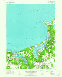
1955 Map of Saint James
USGS Topo · Published 1963About this map
Kings Park State Hospital anchors the western landscape of this mid-century survey, surrounded by the growing residential patterns of Kings Park and San Remo. The shoreline of Smithtown Bay is defined by complex coastal features, from the recreational grounds of Sunken Meadow State Park to the narrow spit of Long Beach protecting the entrance to Stony Brook Harbor. These waters provided essential navigation routes through Porpoise Channel, connecting the maritime communities of Old Field and Stony Brook to the Long Island Sound.
Find a feature on this map
56 named features on this map. Tap any name to fly to it.
Don’t see what you’re looking for? This feature index may not catch every label — zoom into the map to look around manually.
Map Details
Editions of this 1955 Saint James Map
This is the sole edition of this map. No revisions or reprints were ever made.
Other maps of this area

1891 · Bridgeport
USGS Topo · 1:62,500

1892 · Norwalk
USGS Topo · 1:62,500

1893 · Bridgeport
USGS Topo · 1:62,500

1893 · Norwalk
USGS Topo · 1:62,500

1901 · Northport
USGS Topo · 1:62,500

1902 · Setauket
USGS Topo · 1:62,500

1903 · Northport
USGS Topo · 1:62,500

1904 · Setauket
USGS Topo · 1:62,500

1904 · Islip
USGS Topo · 1:125,000

1919 · Setauket
USGS Topo · 1:62,500