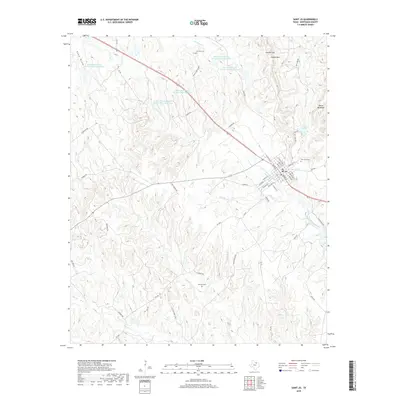
2019 Map of Saint Jo
USGS Topo · Published 2019About this map
St. Jo serves as the focal point of this North Texas landscape, where the upper reaches of the Elm Fork Trinity River begin their southward journey. The terrain is defined by significant elevations like Gordon Mtn and the striking ridge known as Devils Backbone, creating a complex series of draws and gaps such as Deep Draw and Gordon Gap. The region's water management is evident through a series of numbered Soil Conservation Service reservoirs, integrated among natural drainages like Farmers Cr and Buck Br. Local history and genealogy are anchored by Fairview Cem to the north and McGrady Cem to the south, while Mountain Park and Katy Lake suggest a landscape developed for both agricultural utility and local recreation in Montague County.
Find a feature on this map
60 named features on this map. Tap any name to fly to it.
Don’t see what you’re looking for? This feature index may not catch every label — zoom into the map to look around manually.
Map Details
Editions of this 2019 Saint Jo Map
This is the sole edition of this map. No revisions or reprints were ever made.
Other maps of this area

1902 · Gainesville
USGS Topo · 1:125,000

1905 · Montague
USGS Topo · 1:125,000

1943 · Gainesville
USGS Topo · 1:125,000

1954 · Sherman
USGS Topo · 1:250,000

1958 · Sherman
USGS Topo · 1:250,000

1961 · Muenster West
USGS Topo · 1:24,000

1961 · Saint Jo
USGS Topo · 1:24,000

1961 · Salona
USGS Topo · 1:24,000

1961 · Freemound
USGS Topo · 1:24,000

1961 · Montague
USGS Topo · 1:24,000