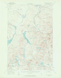
1958 Map of Saint John Pond
USGS Topo · Published 1962About this map
St John Pond Depot serves as a lone marker of human infrastructure within this 1950s survey of the Somerset County wilderness. The landscape is defined by the headwaters of the St John River, which gathers from a network of remote brooks including Campbell Brook and Sweeney Brook. The terrain is dominated by significant elevations such as Russell Mtn, Seboomook Mtn, and the prominent Summit Ridge. A solitary Lookout Tower on Little Russell Mtn highlights the region's importance for fire overwatch in the dense timberlands. The mapping reflects the complex township and range system peculiar to Maine's unorganized territories, showing divisions like t6 r17 Wels and T4 R16 WELS (Elm Stream). Resource extraction and access are hinted at by a Gravel Pit near Abacotnetic Stream and several miles of Jeep Trail.
Find a feature on this map
76 named features on this map. Tap any name to fly to it.
Don’t see what you’re looking for? This feature index may not catch every label — zoom into the map to look around manually.
Map Details
Editions of this 1958 Saint John Pond Map
2 editions found

Other maps of this area

1949 · Jackman
USGS Topo · 1:250,000

1954 · Seboomook Lake
USGS Topo · 1:62,500

1954 · North East Carry
USGS Topo · 1:62,500

1954 · Baker Lake
USGS Topo · 1:62,500

1954 · Caucomgomoc Lake
USGS Topo · 1:62,500

1954 · Allagash Lake
USGS Topo · 1:62,500

1954 · St. John Pond
USGS Topo · 1:62,500

1954 · Presque Isle
USGS Topo · 1:250,000

1954 · Millinocket
USGS Topo · 1:250,000

1956 · Penobscot Lake
USGS Topo · 1:62,500