
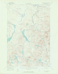
1958 Map of Saint John Pond
USGS Topo · Published 1962About this map
St John Pond Depot serves as the central landmark in this remote reach of the Maine woods, situated near the northern shore of Fifth St John Pond. The landscape is defined by the headwaters of the North Branch Penobscot River and a series of interconnected water bodies, including Third St John Pond and Fourth St John Pond. This 1950s terrain reflects the traditional township and range divisions of the West of East Line State (WELS), including t6 r17 Wels and t5 r17 Wels. Topography is punctuated by isolated peaks like Little Russell Mtn and Nulhedus Mtn, where a Lookout Tower once monitored the surrounding timberlands. Numerous bogs and streams, such as Big Bog and Abacotnetic Stream, indicate a complex drainage system essential to the regional logging history and natural hydrology.
Find a feature on this map
85 named features on this map. Tap any name to fly to it.
Don’t see what you’re looking for? This feature index may not catch every label — zoom into the map to look around manually.
Map Details
Editions of this 1958 Saint John Pond Map
2 editions found
Other maps of this area

1949 · Jackman
USGS Topo · 1:250,000

1954 · Seboomook Lake
USGS Topo · 1:62,500

1954 · North East Carry
USGS Topo · 1:62,500

1954 · Baker Lake
USGS Topo · 1:62,500

1954 · Caucomgomoc Lake
USGS Topo · 1:62,500

1954 · Allagash Lake
USGS Topo · 1:62,500

1954 · St. John Pond
USGS Topo · 1:62,500

1954 · Presque Isle
USGS Topo · 1:250,000

1954 · Millinocket
USGS Topo · 1:250,000

1956 · Penobscot Lake
USGS Topo · 1:62,500