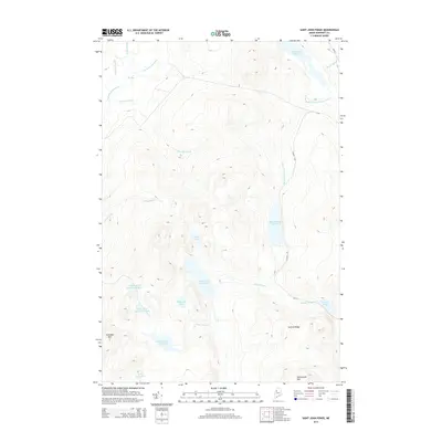
2014 Map of Saint John Ponds
USGS Topo · Published 2014About this map
Upper First Saint John Pond and its subsequent downstream basins form the centerpiece of this interior Somerset County landscape. The topography is defined by the high elevations of Truesdale Mtn and Seboomook Mtn, which frame a dense network of hydrologic features including Robinson Pond, Austin Pond, and Little Lane Pond. These waters feed into the Baker Br Saint John River and Baker Stream, illustrating the complex drainage patterns of the Maine woods before they reach the larger river systems. A few primitive routes like Access RD and 4th ST provide the only terrestrial navigation through the area. The map reveals a land utilized for its timber and water resources, where the transition from Summit Ridge down to the Big Bog near the N Br Penobscot River highlights the varied wetland and mountain terrain.
Find a feature on this map
25 named features on this map. Tap any name to fly to it.
Don’t see what you’re looking for? This feature index may not catch every label — zoom into the map to look around manually.
Map Details
Editions of this 2014 Saint John Ponds Map
This is the sole edition of this map. No revisions or reprints were ever made.
Other maps of this area

1949 · Jackman
USGS Topo · 1:250,000

1954 · Seboomook Lake
USGS Topo · 1:62,500

1954 · St. John Pond
USGS Topo · 1:62,500

1954 · Presque Isle
USGS Topo · 1:250,000

1954 · Millinocket
USGS Topo · 1:250,000

1956 · Penobscot Lake
USGS Topo · 1:62,500

1957 · Norris Brook
USGS Topo · 1:62,500

1958 · Presque Isle
USGS Topo · 1:250,000

1958 · Millinocket
USGS Topo · 1:250,000

1958 · Saint John Pond
USGS Topo · 1:62,500