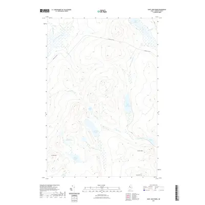
2021 Map of Saint John Ponds
USGS Topo · Published 2021About this map
The N Br Penobscot River flows through this remote section of Somerset County, where a chain of interconnected waterways forms the primary character of the landscape. This 2021 survey details the Saint John Ponds system, stretching from the northern Fifth Saint John Pond through the Fourth, Third, and Second basins, terminating in the Lower First Saint John Pond at the foot of Truesdale Mtn. Significant elevation changes are marked by Summit Ridge and the heights of Seboomook Mtn, which overlook a network of seasonal brooks and logging access routes. The presence of the N Branch Access Rd and 4th St indicates the continued utility of this area for timber management, while features like Big Bog and Austin Pond highlight the complex hydrography of the Maine North Woods.
Find a feature on this map
24 named features on this map. Tap any name to fly to it.
Don’t see what you’re looking for? This feature index may not catch every label — zoom into the map to look around manually.
Map Details
Editions of this 2021 Saint John Ponds Map
This is the sole edition of this map. No revisions or reprints were ever made.
Other maps of this area

1949 · Jackman
USGS Topo · 1:250,000

1954 · Seboomook Lake
USGS Topo · 1:62,500

1954 · St. John Pond
USGS Topo · 1:62,500

1954 · Presque Isle
USGS Topo · 1:250,000

1954 · Millinocket
USGS Topo · 1:250,000

1956 · Penobscot Lake
USGS Topo · 1:62,500

1957 · Norris Brook
USGS Topo · 1:62,500

1958 · Presque Isle
USGS Topo · 1:250,000

1958 · Millinocket
USGS Topo · 1:250,000

1958 · Saint John Pond
USGS Topo · 1:62,500