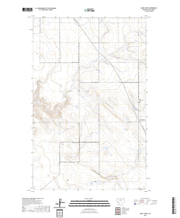
2024 Map of Saint Johns
USGS Topo · Published 2024About this map
Saint Johns anchors this section of Hill County, where the plains are marked by intermittent drainages and the long-established path of the Wild Horse Trl. This trail, which cuts diagonally across the northern townships, represents a historical corridor through the high country long before modern survey grids were established. The presence of the Saint Johns Catholic Cem near the intersection of Cottonwood Rd indicates a localized history of settlement and faith in this northern Montana landscape. The topography is defined by subtle elevation shifts across sections of t36n r12e and t35n r13e, showing a land primarily organized by the Public Land Survey System and accessed by straight-line routes like Base Rd.
Find a feature on this map
10 named features on this map. Tap any name to fly to it.
Don’t see what you’re looking for? This feature index may not catch every label — zoom into the map to look around manually.
Map Details
Editions of this 2024 Saint Johns Map
This is the sole edition of this map. No revisions or reprints were ever made.
Other maps of this area

1904 · Assinniboine
USGS Topo · 1:62,500

1906 · Kremlin
USGS Topo · 1:62,500

1912 · Thibedeau Lake
USGS Topo · 1:125,000

1920 · Gildford
USGS Topo · 1:125,000

1943 · Gildford
USGS Topo · 1:125,000

1953 · Havre
USGS Topo · 1:250,000

1954 · Shelby
USGS Topo · 1:250,000

1957 · Havre
USGS Topo · 1:250,000

1958 · Shelby
USGS Topo · 1:250,000

1958 · Havre
USGS Topo · 1:250,000