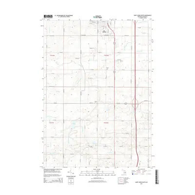
2014 Map of Saint Johns South
USGS Topo · Published 2014About this map
St. Johns occupies the northern edge of this landscape, serving as a hub for the surrounding agricultural reaches of Clinton County. The area is defined by an extensive and organized network of drainage systems, such as the Shulters and Stubbs Drain and Bond and Palmer Drain, which facilitate the cultivation of this flat Michigan terrain. These man-made waterways feed into natural features like Stony Creek and the western edge of Muskrat Lake. For genealogists and local historians, several rural burial grounds are preserved across the townships, including S Bingham Cem and Alward Lake Cem near the southern shore of Alward Lake. The map illustrates a transitional period of infrastructure, showing the path of S Old US 27 running parallel to the modern highway corridor, reflecting the evolving transportation patterns of the region.
Find a feature on this map
75 named features on this map. Tap any name to fly to it.
Don’t see what you’re looking for? This feature index may not catch every label — zoom into the map to look around manually.
Map Details
Editions of this 2014 Saint Johns South Map
This is the sole edition of this map. No revisions or reprints were ever made.
Other maps of this area

1918 · Elsie
USGS Topo · 1:62,500

1918 · Perrinton
USGS Topo · 1:62,500

1927 · De Witt
USGS Topo · 1:62,500

1928 · Laingsburg
USGS Topo · 1:62,500

1943 · Perrinton
USGS Topo · 1:62,500

1943 · Elsie
USGS Topo · 1:62,500

1944 · Laingsburg
USGS Topo · 1:62,500

1954 · Midland
USGS Topo · 1:250,000

1958 · Midland
USGS Topo · 1:250,000

1958 · Grand Rapids
USGS Topo · 1:250,000