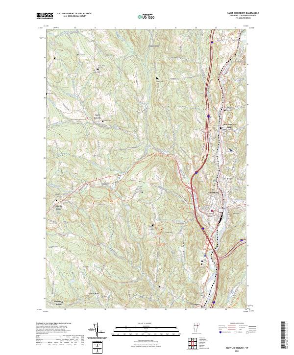
2024 Map of Saint Johnsbury
USGS Topo · Published 2024About this map
St. Johnsbury serves as the focal point of this Vermont landscape, where the confluence of the Passumpsic River and Moose River historically shaped the region's development. The presence of the Caledonia County Courthouse and numerous organized cemetery plots, such as Mount Calvary Cem and New Saint Johnsbury Center Cem, highlights its role as a civic and family center. The map reveals a dense network of hamlets including North Danville, Danville Center, and Passumpsic, reflecting the traditional Vermont pattern of dispersed but interconnected small settlements.
Find a feature on this map
140 named features on this map. Tap any name to fly to it.
Don’t see what you’re looking for? This feature index may not catch every label — zoom into the map to look around manually.
Map Details
Editions of this 2024 Saint Johnsbury Map
This is the sole edition of this map. No revisions or reprints were ever made.
Other maps of this area

1931 · Littleton
USGS Topo · 1:62,500

1932 · Littleton
USGS Topo · 1:48,000

1935 · Littleton
USGS Topo · 1:62,500

1935 · Lyndonville
USGS Topo · 1:48,000

1938 · St. Johnsbury
USGS Topo · 1:48,000

1939 · Lyndonville
USGS Topo · 1:62,500

1943 · St. Johnsbury
USGS Topo · 1:62,500
1949 · St. Johnsbury
USGS Topo · 1:62,500

1950 · Lake Champlain
USGS Topo · 1:250,000

1950 · Lewiston
USGS Topo · 1:250,000