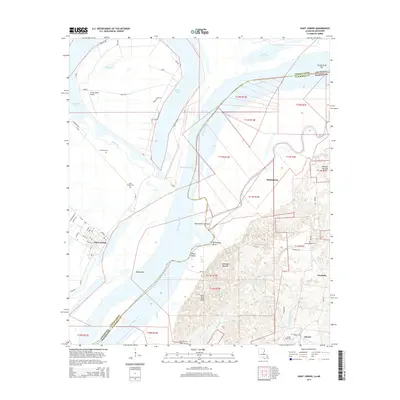
2015 Map of Saint Joseph
USGS Topo · Published 2015About this map
Saint Joseph sits on the western bank of the Mississippi River, anchored by a grid of streets such as Panola St and Hancock St. Across the state line in Mississippi, the landscape shifts from the river bottomlands to the Petit Gulf Hills, where Alcorn State Univ and the community of Alcorn are situated. This riverine borderland is defined by complex water patterns, including Bondurant Chute, Bruinsburg Bend, and several oxbow features like Brushy Lake and Big Pond.
Find a feature on this map
69 named features on this map. Tap any name to fly to it.
Don’t see what you’re looking for? This feature index may not catch every label — zoom into the map to look around manually.
Map Details
Editions of this 2015 Saint Joseph Map
This is the sole edition of this map. No revisions or reprints were ever made.
Other maps of this area

1909 · Delta Bridge
USGS Topo · 1:24,000

1909 · Lake Bruen
USGS Topo · 1:24,000

1935 · Shackleford Lake
USGS Topo · 1:62,500

1939 · Lorman
USGS Topo · 1:62,500

1939 · Locust Ridge
USGS Topo · 1:62,500

1953 · Natchez
USGS Topo · 1:250,000

1955 · Jackson
USGS Topo · 1:250,000

1956 · Natchez
USGS Topo · 1:250,000

1958 · Shackleford Lake
USGS Topo · 1:62,500

1958 · St. Joseph
USGS Topo · 1:62,500