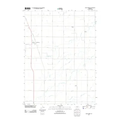
2011 Map of Saint Libory
USGS Topo · Published 2011About this map
Saint Libory and the small settlement of Worms anchor this agricultural landscape in eastern Howard County. The terrain is defined by a dense network of watercourses, most notably the meandering Prairie Creek and its associated Prairie Slough, alongside Moores Creek to the south. These drainage patterns reflect the high water table and fertile bottoms characteristic of the region. Local heritage is preserved at the Norwegian Cemetery and Weigert Cemetery, which serve as quiet markers of the area's early families and pioneer history.
Find a feature on this map
37 named features on this map. Tap any name to fly to it.
Don’t see what you’re looking for? This feature index may not catch every label — zoom into the map to look around manually.
Map Details
Editions of this 2011 Saint Libory Map
This is the sole edition of this map. No revisions or reprints were ever made.
Other maps of this area

1892 · Grand Island
USGS Topo · 1:62,500

1895 · Grand Island
USGS Topo · 1:62,500

1898 · Grand Island
USGS Topo · 1:125,000

1899 · St. Paul
USGS Topo · 1:125,000

1955 · Broken Bow
USGS Topo · 1:250,000

1955 · Grand Island
USGS Topo · 1:250,000

1956 · Broken Bow
USGS Topo · 1:250,000

1957 · Grand Island
USGS Topo · 1:250,000

1958 · Grand Island
USGS Topo · 1:250,000
1960 · St. Paul
USGS Topo · 1:24,000