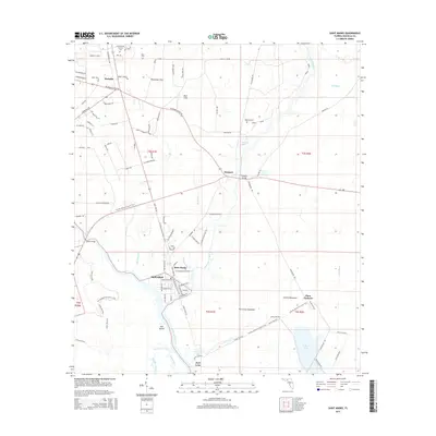
2015 Map of Saint Marks
USGS Topo · Published 2015About this map
The confluence of the Wakulla River and the Saint Marks River anchors this coastal Florida landscape, where the historic settlement of Saint Marks sits at the water's edge. This environment is characterized by its complex hydrology, featuring numerous karst landforms such as Patterson Sink, Blue Sink, and Newport Spring. Farther south, the river system opens into the E River Pool and Big West Bayou, surrounded by expansive wetlands like Port Leon Hammock.
Find a feature on this map
96 named features on this map. Tap any name to fly to it.
Don’t see what you’re looking for? This feature index may not catch every label — zoom into the map to look around manually.
Map Details
Editions of this 2015 Saint Marks Map
This is the sole edition of this map. No revisions or reprints were ever made.
Other maps of this area

1940 · Tallahassee
USGS Topo · 1:62,500

1940 · Arran
USGS Topo · 1:62,500

1942 · Tallahassee
USGS Topo · 1:62,500

1943 · Arran
USGS Topo · 1:62,500

1943 · Tallahassee
USGS Topo · 1:62,500

1954 · Sprague Island
USGS Topo · 1:24,000

1954 · Cody
USGS Topo · 1:24,000

1954 · Woodville
USGS Topo · 1:24,000

1954 · St. Marks NE
USGS Topo · 1:24,000

1954 · St. Marks
USGS Topo · 1:24,000