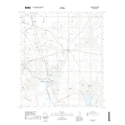
2021 Map of Saint Marks
USGS Topo · Published 2021About this map
The confluence of the Saint Marks River and the Wakulla River anchors this coastal landscape, where the settlement of St. Marks stands at the head of the Apalachee Bay drainage. To the south, the wetland reaches of Port Leon and Shell Island mark the transition toward the gulf, while the inland forest is dotted with unique hydrological features like Patterson Sink, Blue Sink, and Newport Spring. The transportation history of the region is traced by the Tallahassee Saint Marks Historic Railroad State Trl, following the path of one of Florida's earliest rail corridors. To the north, the small communities of Wakulla and Newport are connected by local routes like Bloxham Cutoff Rd, providing a detailed look at the rural cemetery locations at Mays Cem and Magnolia Cem alongside the hammocks and bayous of the coastal plain.
Find a feature on this map
89 named features on this map. Tap any name to fly to it.
Don’t see what you’re looking for? This feature index may not catch every label — zoom into the map to look around manually.
Map Details
Editions of this 2021 Saint Marks Map
This is the sole edition of this map. No revisions or reprints were ever made.
Other maps of this area

1940 · Tallahassee
USGS Topo · 1:62,500

1940 · Arran
USGS Topo · 1:62,500

1942 · Tallahassee
USGS Topo · 1:62,500

1943 · Arran
USGS Topo · 1:62,500

1943 · Tallahassee
USGS Topo · 1:62,500

1954 · Sprague Island
USGS Topo · 1:24,000

1954 · Cody
USGS Topo · 1:24,000

1954 · Woodville
USGS Topo · 1:24,000

1954 · St. Marks NE
USGS Topo · 1:24,000

1954 · St. Marks
USGS Topo · 1:24,000