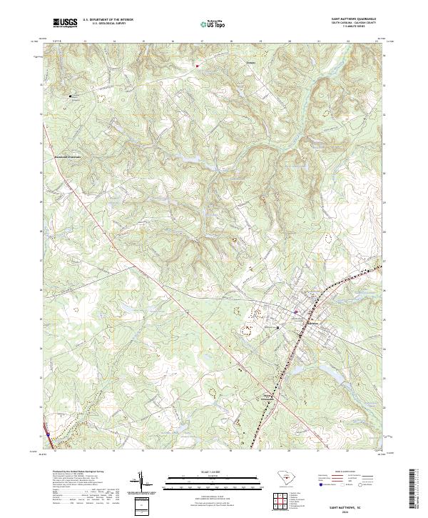
2024 Map of Saint Matthews
USGS Topo · Published 2024About this map
St. Matthews serves as the focal point of this South Carolina landscape, dominated by the Calhoun County Courthouse and a network of traditional crossroads settlements. The geography is defined by a dense concentration of family-named ponds and hydrological features, such as Peter Buyck House Pond, Wannamakers Pond, and Bobby Gressett Pond, which suggest a long history of local land ownership and small-scale water management.
Find a feature on this map
131 named features on this map. Tap any name to fly to it.
Don’t see what you’re looking for? This feature index may not catch every label — zoom into the map to look around manually.
Map Details
Editions of this 2024 Saint Matthews Map
This is the sole edition of this map. No revisions or reprints were ever made.
Other maps of this area

1943 · Eastover
USGS Topo · 1:62,500

1946 · Elloree
USGS Topo · 1:62,500

1946 · St. Matthews
USGS Topo · 1:62,500

1948 · Hopkins
USGS Topo · 1:62,500

1953 · Saylors Lake
USGS Topo · 1:24,000

1953 · Gadsden
USGS Topo · 1:24,000

1953 · Wateree
USGS Topo · 1:24,000

1954 · Augusta
USGS Topo · 1:250,000

1957 · Augusta
USGS Topo · 1:250,000

1958 · Augusta
USGS Topo · 1:250,000