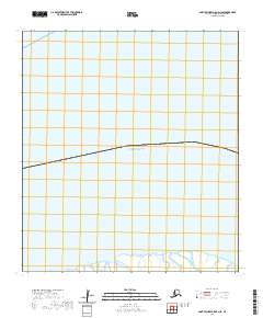
2020 Map of Saint Michael A-5 OE N SE
USGS Topo · Published 2020About this map
Norton Sound dominates this coastal survey, where the waters of the Bering Sea meet the intricate marshlands of the Yukon-Kuskokwim Delta. The map focuses on the shoreline interface within the Kusilvak Census Area, illustrating a transition from open water to the complex tidal environment of the mainland. Further south, the meandering path of Uwik Slough cuts through the low-lying wetlands, serving as a primary hydrological feature in this sparsely populated region. The mapping reflects the administrative divisions of the Public Land Survey System, specifically marking the boundaries of t26s r29w and t26s r28w. This 2020 document provides a precise record of the shifting Alaskan coastline and its sensitive wetland ecosystems, essential for understanding the environmental geography of the northern delta region.
Find a feature on this map
4 named features on this map. Tap any name to fly to it.
Don’t see what you’re looking for? This feature index may not catch every label — zoom into the map to look around manually.
Map Details
Editions of this 2020 Saint Michael A-5 OE N SE Map
This is the sole edition of this map. No revisions or reprints were ever made.
Other maps of this area

1951 · St Michael
USGS Topo · 1:250,000

1952 · Saint Michael A-5
USGS Topo · 1:63,360
1952 · Saint Michael A-4
USGS Topo · 1:63,360

1952 · St Michael
USGS Topo · 1:250,000

1964 · St. Michael
USGS Topo · 1:250,000
2020 · Saint Michael A-5 NE
USGS Topo · 1:25,000
2020 · Saint Michael A-4 NW
USGS Topo · 1:25,000
2020 · Saint Michael A-4 OE N SW
USGS Topo · 1:25,000
2020 · Saint Michael A-5 NW
USGS Topo · 1:25,000