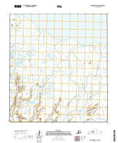
2020 Map of Saint Michael A-4 NW
USGS Topo · Published 2020About this map
Norton Sound defines the northern edge of this coastal landscape within the Saint Michael A-4 NW quadrangle. The terrain is characterized by an extensive system of coastal wetlands and intricate waterways, illustrating the complex drainage patterns common to the Kusilvak Census Area. This 2020 record captures the shifting interface between the land and the tidal waters of the sound, dominated by a vast network of marshes and small lakes. Surveyed under the Public Land Survey System, the map details sections within Townships t26s r28w, t26s r27w, t27s r28w, and t27s r27w, providing a precise look at the township and range grid as it sits across this remote portion of the Alaskan coast.
Find a feature on this map
5 named features on this map. Tap any name to fly to it.
Don’t see what you’re looking for? This feature index may not catch every label — zoom into the map to look around manually.
Map Details
Editions of this 2020 Saint Michael A-4 NW Map
This is the sole edition of this map. No revisions or reprints were ever made.
Other maps of this area

1951 · St Michael
USGS Topo · 1:250,000

1952 · Saint Michael A-5
USGS Topo · 1:63,360
1952 · Saint Michael A-4
USGS Topo · 1:63,360

1952 · St Michael
USGS Topo · 1:250,000

1964 · St. Michael
USGS Topo · 1:250,000
2020 · Saint Michael A-5 NE
USGS Topo · 1:25,000
2020 · Saint Michael A-4 NE
USGS Topo · 1:25,000
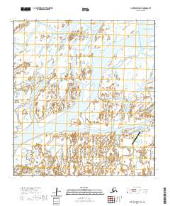
2020 · Saint Michael A-4 SE
USGS Topo · 1:25,000
2020 · Saint Michael A-4 OE N SW
USGS Topo · 1:25,000
2020 · Saint Michael A-5 OE N SE
USGS Topo · 1:25,000