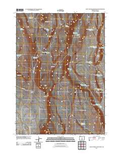
2011 Map of Saint Patrick Mountain
USGS Topo · Published 2011About this map
Saint Patrick Mountain anchors this high-desert landscape in Lake County, Oregon, where a sophisticated network of water management features reveals the importance of every drop in this arid terrain. The landscape is defined by its numerous specialized water sources, ranging from the Settlement Waterhole and Dog Lake Waterhole to designated areas like State Game Reservoir Number 7. This distribution of waterholes, many bearing county and state game designations, implies a region heavily utilized for livestock grazing and wildlife conservation during the early 21st century.
Find a feature on this map
29 named features on this map. Tap any name to fly to it.
Don’t see what you’re looking for? This feature index may not catch every label — zoom into the map to look around manually.
Map Details
Editions of this 2011 Saint Patrick Mountain Map
This is the sole edition of this map. No revisions or reprints were ever made.
Other maps of this area

1955 · Crescent
USGS Topo · 1:250,000

1955 · Klamath Falls
USGS Topo · 1:250,000

1957 · Crescent
USGS Topo · 1:250,000

1958 · Crescent
USGS Topo · 1:250,000

1958 · Klamath Falls
USGS Topo · 1:250,000

1970 · Crescent
USGS Topo · 1:250,000

1974 · Lake Abert
USGS Topo · 1:100,000

1986 · St. Patrick Mtn.
USGS Topo · 1:24,000
1986 · Christmas Valley
USGS Topo · 1:24,000
1986 · Ana River
USGS Topo · 1:24,000