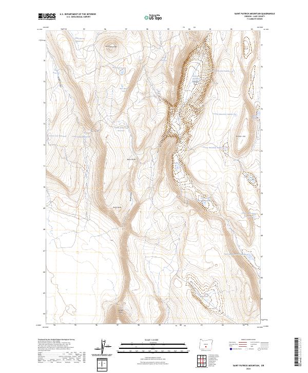
2024 Map of Saint Patrick Mountain
USGS Topo · Published 2024About this map
Saint Patrick Mtn dominates this high-desert landscape in Lake County, defining a rugged terrain marked by volcanic rims and ephemeral water sources. The map reveals an essential network of water management in a dry environment, ranging from the Saint Patrick Reservoir and Saint Patrick Lake in the north to the dramatic Diablo Rim at the southern boundary. The presence of numerous numbered waterholes, such as County Waterhole Number 2 and Dog Lake Waterhole, alongside named catchments like the Settlement Waterhole in Coffeepot Basin, illustrates the historical and ongoing reliance on surface water for ranching and wildlife in this part of Oregon. These features, along with landmarks like Black Points and Bunker Hill, provide a clear picture of the land use patterns dictated by the area's arid geography.
Find a feature on this map
33 named features on this map. Tap any name to fly to it.
Don’t see what you’re looking for? This feature index may not catch every label — zoom into the map to look around manually.
Map Details
Editions of this 2024 Saint Patrick Mountain Map
This is the sole edition of this map. No revisions or reprints were ever made.
Other maps of this area

1955 · Crescent
USGS Topo · 1:250,000

1955 · Klamath Falls
USGS Topo · 1:250,000

1957 · Crescent
USGS Topo · 1:250,000

1958 · Crescent
USGS Topo · 1:250,000

1958 · Klamath Falls
USGS Topo · 1:250,000

1970 · Crescent
USGS Topo · 1:250,000

1974 · Lake Abert
USGS Topo · 1:100,000

1986 · St. Patrick Mtn.
USGS Topo · 1:24,000
1986 · Christmas Valley
USGS Topo · 1:24,000
1986 · Ana River
USGS Topo · 1:24,000