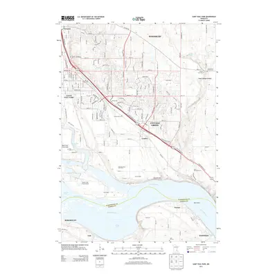
2013 Map of Saint Paul Park
USGS Topo · Published 2013About this map
The Mississippi River carves a deep path through this landscape, separating Washington Co from Dakota Co and creating a complex system of islands and backwaters. The terrain is defined by the broad river valley where Grey Cloud Island and Buck Island sit amidst channels like the Grey Cloud Channel and Mooers Lake. On the higher ground, suburban development in Woodbury and Saint Paul Park is balanced by extensive recreational and agricultural spaces, including the Mississippi Dunes Golf Course and Grove Orchard.
Find a feature on this map
59 named features on this map. Tap any name to fly to it.
Don’t see what you’re looking for? This feature index may not catch every label — zoom into the map to look around manually.
Map Details
Editions of this 2013 Saint Paul Park Map
This is the sole edition of this map. No revisions or reprints were ever made.
Other maps of this area

1896 · St. Paul
USGS Topo · 1:62,500

1946 · Hudson
USGS Topo · 1:62,500

1949 · Hudson
USGS Topo · 1:62,500

1949 · Lake Elmo
USGS Topo · 1:24,000

1949 · Hudson
USGS Topo · 1:24,000

1950 · Lake Elmo
USGS Topo · 1:24,000

1950 · Hudson
USGS Topo · 1:24,000

1950 · St Paul Park
USGS Topo · 1:24,000

1951 · St Paul Park
USGS Topo · 1:24,000

1951 · Prescott
USGS Topo · 1:24,000