
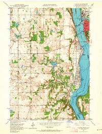
1949 Map of Hudson
USGS Topo · Published 1958About this map
Lake St Croix serves as the central artery for this late 1940s landscape, dividing the communities of Hudson and Lakeland across the Minnesota-Wisconsin border. The industrial and transit character of the riverfront is defined by the Chicago and North Western and Chicago Milwaukee St Paul and Pacific railroads, alongside a Toll Bridge and the Power Plant and Dam at Lake Mallalieu.
Find a feature on this map
43 named features on this map. Tap any name to fly to it.
Don’t see what you’re looking for? This feature index may not catch every label — zoom into the map to look around manually.
Map Details
Editions of this 1949 Hudson Map
2 editions found
Other maps of this area

1946 · Hudson
USGS Topo · 1:62,500

1946 · River Falls
USGS Topo · 1:62,500

1948 · New Richmond
USGS Topo · 1:62,500

1948 · Stillwater
USGS Topo · 1:62,500

1949 · New Richmond
USGS Topo · 1:62,500

1949 · River Falls
USGS Topo · 1:62,500

1949 · Hudson
USGS Topo · 1:62,500

1949 · Stillwater
USGS Topo · 1:62,500

1949 · Lake Elmo
USGS Topo · 1:24,000

1950 · Lake Elmo
USGS Topo · 1:24,000