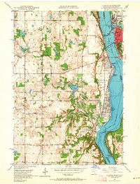
1949 Map of Hudson
USGS Topo · Published 1964About this map
Hudson and its neighboring Minnesota settlements define the shoreline of the St Croix River at mid-century, where the river widens into Lake St Croix. The mapping captures a period when regional travel relied on the Toll Bridge connecting Wisconsin and Minnesota, and heavy rail traffic moved along the Chicago Milwaukee St Paul and Pacific and Chicago and North Western lines. Away from the riverside hubs of Lakeland and North Hudson, the landscape transitions into agricultural townships like Baytown and West Lakeland.
Find a feature on this map
50 named features on this map. Tap any name to fly to it.
Don’t see what you’re looking for? This feature index may not catch every label — zoom into the map to look around manually.
Map Details
Editions of this 1949 Hudson Map
2 editions found
Other maps of this area

1946 · Hudson
USGS Topo · 1:62,500

1946 · River Falls
USGS Topo · 1:62,500

1948 · New Richmond
USGS Topo · 1:62,500

1948 · Stillwater
USGS Topo · 1:62,500

1949 · New Richmond
USGS Topo · 1:62,500

1949 · River Falls
USGS Topo · 1:62,500

1949 · Hudson
USGS Topo · 1:62,500

1949 · Stillwater
USGS Topo · 1:62,500

1949 · Lake Elmo
USGS Topo · 1:24,000

1949 · Hudson
USGS Topo · 1:24,000